The Geostationary Operational Environmental Satellite (GOES) is a series of highly advanced weather satellites designed to monitor and observe Earth’s weather and environmental conditions from a geostationary orbit. These satellites play a crucial role in providing accurate and timely weather data, facilitating meteorological forecasting, climate monitoring, and disaster management. Developed and operated by the National Oceanic and Atmospheric Administration (NOAA) in collaboration with the National Aeronautics and Space Administration (NASA), GOES has revolutionized our understanding of weather patterns and has greatly enhanced our ability to predict and mitigate the impacts of severe weather events.
History and Development
The concept of geostationary weather satellites originated in the 1960s, driven by the need for continuous monitoring of meteorological conditions over a fixed geographic region. The first operational GOES satellite, GOES-1, was launched in 1975, marking the beginning of a groundbreaking era in weather forecasting. Since then, several generations of GOES satellites have been launched, each incorporating technological advancements to improve the accuracy and coverage of weather data.
Orbit and Geostationary Capability
GOES satellites are placed in a geostationary orbit, approximately 35,786 kilometers (22,236 miles) above the Earth’s equator. This orbit allows the satellites to match the rotational period of the Earth, enabling them to remain fixed above a specific region on the planet’s surface. The geostationary capability is crucial for continuous monitoring of weather patterns in real time, as the satellite remains stationary relative to the Earth’s surface.
Instrumentation and Data Collection
GOES satellites are equipped with a comprehensive suite of advanced sensors and instruments designed to capture a wide range of meteorological and environmental data. These include:
- Advanced Baseline Imager (ABI): The ABI provides high-resolution images of Earth’s surface, atmosphere, and cloud cover. It captures images in multiple spectral bands, enabling meteorologists to analyze cloud properties, atmospheric moisture, volcanic ash, and other crucial weather indicators.
- Geostationary Lightning Mapper (GLM): The GLM detects and maps lightning activity across the entire hemisphere covered by the satellite. This information aids in tracking severe thunderstorms, identifying areas prone to severe weather, and providing valuable input for severe weather warnings.
- Solar Ultraviolet Imager (SUVI): The SUVI monitors the sun’s ultraviolet emissions, aiding in space weather prediction and understanding the impact of solar activity on Earth’s atmosphere and climate.
- Space Environment In-Situ Suite (SEISS): The SEISS instruments measure charged particles and magnetic fields in the near-Earth environment, assisting in space weather forecasting and understanding the interaction between solar activity and Earth’s magnetosphere.
Data Dissemination and Applications
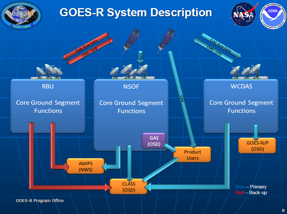
The data collected by GOES satellites are transmitted to Earth and made available to meteorological agencies, researchers, and the general public. Weather forecasters rely heavily on GOES data to generate accurate and timely forecasts, identify severe weather conditions, and issue warnings for tropical storms, hurricanes, tornadoes, and other weather-related hazards. The data also contribute to long-term climate studies, atmospheric research, and environmental monitoring.
Additionally, the GOES satellites serve as a crucial component of the international weather satellite network, providing invaluable data for global weather prediction models and collaborations with other nations.

Future Developments
NOAA and NASA are continually working on advancing the capabilities of GOES satellites. The latest generation, GOES-R series, introduced improved imaging capabilities, increased temporal resolution, and enhanced lightning detection. Efforts are also underway to develop and launch next-generation satellites, such as GOES-T and GOES-U, which will further refine weather monitoring capabilities and offer enhanced capabilities in data collection, analysis, and dissemination.
In the future, the development of advanced instruments and sensors will continue to enhance the GOES satellite system. The integration of new technologies, such as hyperspectral imaging and improved spatial resolution, will provide even more detailed and accurate data for weather forecasting and environmental monitoring. These advancements will enable meteorologists and researchers to gain deeper insights into atmospheric dynamics, climate change, and the intricate processes that drive weather patterns.
Furthermore, ongoing efforts are being made to improve the data dissemination systems associated with GOES satellites. The availability of real-time data through web-based portals, mobile applications, and other platforms allows a broader range of users, including emergency management agencies, industries, and the general public, to access and utilize timely weather information. This accessibility plays a vital role in mitigating the impact of severe weather events, facilitating timely decision-making, and protecting lives and property.
The GOES satellite system also collaborates with other international meteorological satellite programs, such as the European Meteosat series, to enhance global weather monitoring and forecasting capabilities. These partnerships promote data sharing, calibration, and validation efforts, ensuring the accuracy and reliability of weather information worldwide.
In conclusion, the Geostationary Operational Environmental Satellite (GOES) system has transformed our understanding of weather patterns and significantly improved our ability to forecast and respond to severe weather events. These satellites, positioned in geostationary orbits, provide continuous and high-resolution data on meteorological conditions, enabling accurate weather forecasts, climate monitoring, and environmental research. With ongoing advancements and future developments, the GOES satellite system will continue to play a pivotal role in enhancing our preparedness and resilience in the face of ever-changing weather patterns and environmental challenges.
What does NASA GOES stand for?
NASA GOES stands for National Aeronautics and Space Administration Geostationary Operational Environmental Satellite.
What are the current GOES satellites?
The current GOES satellites are GOES-16 (also known as GOES-East) and GOES-17 (also known as GOES-West). They were launched in November 2016 and March 2018, respectively.
References:
- National Oceanic and Atmospheric Administration (NOAA). (n.d.). GOES-R Series. Retrieved from https://www.goes-r.gov/
- National Aeronautics and Space Administration (NASA). (n.d.). GOES. Retrieved from https://www.nasa.gov/content/goes
- Kidder, S. Q., & Velden, C. S. (2019). Satellite Meteorology: An Introduction. John Wiley & Sons.
Note: This article is a general overview and does not encompass all technical details and specifications of the GOES satellite system.


